Description
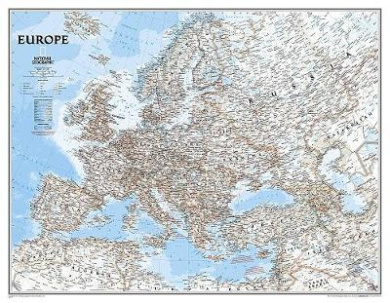
RE00620147 Map Type: Basic Size Laminated (60cm H x 80cm W) The National Geographic classic political map of Europe features country boundaries, place names, bodies of water, airports, major highways and roads, and much more. Every European nation is represented accurately in exquisite detail. In addition, many African nations are also shown. Features: -Detail political markings -All European nations represented -Map Scale: 2.5cm : 133 mi. (standard), 2.5cm : 86 mi. (enlarged) -Basic Maps come rolled, in a cardboard tube -Tubed maps come in a clear plastic storage tube Map Size: -Basic Size: 60cm H x 80cm W -Enlarged Size: 90cm H x 110cm W Map Scale: -Basic Size: 1:8,425,000 -Enlarged Size: 1:5,419,000


